Posts

Special statement

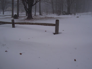
Special Statement expires 10:00 PM EST on February 09, 2013 Statement as of 3:09 PM EST on February 9, 2013 Areas of blowing snow through this evening. Accumulating snow is coming to a quick end across the region this afternoon. Despite an end to the snowfall areas of hazardous travel conditions will still exist. Winds are expected to gust to near 35 mph early diminishing to 25 mph this evening. This will create areas of blowing and drifting snow which can cover roads that have already been cleared. Caution is advised if travel is necessary this evening.

Blizzard statistics and picture

Image
Good morning Augusta, we're still in the midst of a darn good Nor'easter. This morning it is overcast with snow. High of 21F with a windchill as low as -15F. Windy. Winds from the North at 25 to 30 mph with gusts to 45 mph. Chance of snow 100% with accumulations up to 5 in. possible. Tonight it will remain overcast with a chance of snow in the evening, then partly cloudy. Low of 5F with a windchill as low as -4F. Breezy. Winds from the NNW at 10 to 25 mph with gusts to 30 mph. The readings from my own instruments are: The humidity is 89% with a Dew Point of 8.6ºF and a wind chill of -15.6ºF. The temperature is 11.2ºF. Our winds are North with a new recorded maximum wind velocity of 42.5 MPH measured here since super storm Sandy, presently our gusts range between 20.0 MPH and 34.2   MPH. Our Barometric pressure is 29.64/HPA 1004.0 and falling with a weather graphic indicating snow. The UV rating is not measurable owing to the s

special weather statement

Statement as of 11:12 am EST on February 8, 2013 Blizzard Warning expires 4:00 PM EST on February 09, 2013 Blizzard Warning remains in effect from 6 PM this evening to 4 PM EST Saturday. * locations... Androscoggin... Kennebec... interior Waldo... and interior Cumberland counties in Maine. * Hazard types... heavy snow... with significant blowing and drifting. Damaging winds possible late tonight into Saturday morning. * Accumulations... snow accumulation of 18 to 24 inches. * Timing... light to occasionally moderate snow will fall today amounting to a few inches. Conditions will rapidly deteriorate late this afternoon and continue through Saturday... with heavy snow and blowing snow. The worst conditions are expected after midnight tonight through Saturday morning. * Impacts... snow covered roads and low visibilities. Blowing and drifting snow is likely. Whiteout conditions are likely at times. North to northeaster

Blizzard warning up

Good morning Augusta, we're under a blizzard warning so hunker down, we're gonna get it. This morning it is overcast with a chance of snow, then snow in the afternoon. High of 21F. Winds from the NNE at 5 to 10 mph. Chance of snow 100% with accumulations up to 1 in. possible. Tonight it will be overcast with snow. Low of 10F with a windchill as low as -8F. Windy. Winds from the North at 15 to 20 mph with gusts to 35 mph. Chance of snow 100% with accumulations up to 11 in. possible. The readings from my own instruments are: The humidity is 79% with a Dew Point of 1.0ºF and a wind chill of -10.3ºF. The temperature is 6.1ºF. Our winds are presently North between 6.0 MPH and 11.0   MPH. Our Barometric pressure is 30.42/HPA 1030.1 and rising with a weather graphic indicating sun. The UV rating is 0 out of 16, sunset will be at 4:57 PM with Moon Rise   at 5:16 a.m. and the moon phase is Waning Crescent. For the pilots out there:

"Its beginning to look a lot like Xmas!" Blizzard warnings

Blizzard Warning expires 4:00 PM EST on February 09, 2013 Statement as of 3:39 am EST on February 8, 2013 Blizzard Warning in effect from 6 PM this evening to 4 PM EST Saturday. Winter Storm Warning is cancelled. The National Weather Service in gray has issued a Blizzard Warning which is in effect from 6 PM this evening to 4 PM EST Saturday. The Winter Storm Warning has been cancelled. * Locations... Androscoggin... Kennebec... interior Waldo... and interior Cumberland counties in Maine. * Hazard types... heavy snow... with significant blowing and drifting. Damaging winds possible late tonight into Saturday morning. * Accumulations... snow accumulation of 16 to 24 inches. * Timing... light to occasionally moderate snow will fall today amounting to a few inches. Conditions will rapidly deteriorate late this afternoon and continue through Saturday... with heavy snow and blowing snow. The worst conditions are expected

Storm watch elevated to warning status

Winter Storm Warning expires 4:00 PM EST on February 09, 2013 Statement as of 2:56 PM EST on February 7, 2013 Winter Storm Warning in effect from 6 PM Friday to 4 PM EST Saturday. The National Weather Service in gray has issued a Winter Storm Warning for heavy snow which is in effect from 6 PM Friday to 4 PM EST Saturday. The Winter Storm Watch is no longer in effect. * Locations... northern New Hampshire eastward through western Maine to the interior midcoast. * Hazard types... heavy snow... with blowing and drifting. * Accumulations... snow accumulation of 12 to 18 inches. * Timing... a light snow will begin falling early Friday morning... but conditions will rapidly deteriorate Friday evening and continue through Saturday morning. Snow will be heavy at times Friday night into Saturday morning. * Impacts... snow covered roads and low visibilities. Blowing and drifting snow is also likely. * Winds... north 10 to 20

Sunny and clear

Good morning Augusta. We remain under a serious winter storm watch. This morning it is clear with a high of 16F. Winds less than 5 mph. Tonight it will be partly cloudy in the evening, then overcast with a chance of snow. Low of 3F. Winds less than 5 mph. Chance of snow 40%. The readings from my own instruments are: The humidity is 50% with a Dew Point of -8.1ºF and a wind chill of 6.7ºF. The temperature is 6.8ºF. Our winds are West between 1.1 MPH and 5.4   MPH. Our Barometric pressure is 30.36/HPA 1028.1 and rising with a weather graphic indicating sun. The UV rating is 0 out of 16, sunset will be at 4:56 PM with Moon Rise   at 4:29 a.m. and the moon phase is Waning Crescent. For the pilots out there: Raw METAR is – METAR KAUG 071153Z AUTO 30003KT 10SM CLR M15/M23 A3042 RMK AO2 SLP308 T11501233 11122 21156 51034 Visibility is 10.0 Miles/16.1 Kilometers with a good, clear ceiling. We have had no snow in the past 24 hours